TOKYO TOURIST ATTRACTIONS MAP and TRAVEL INFO
Wondering what to do and what to see in Tokyo? Tokyo's top sightseeing attractions are all about the city and most are just a short walk from a subway or train station. Use the Tokyo travel map above and the listing information on Tokyo tourist spots further down this page to make the best use of your time in Tokyo!
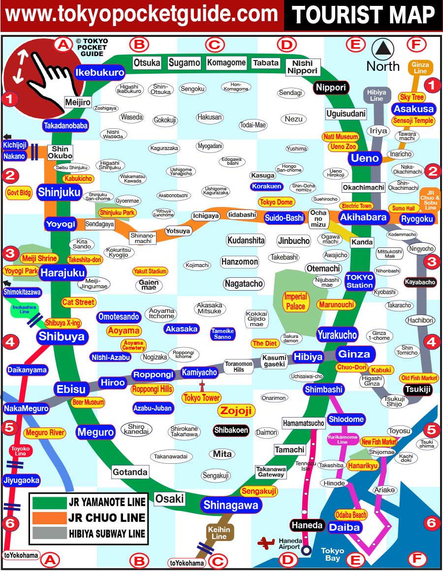
In front of Shibuya station's Hachiko exit every two minutes pedestrians cross from all directions, at peak times over 3000+ people. A good spot to grab a photo from above is the promenade between Shibuya JR station and Mark City.
CLICK FOR SHIBUYA CROSSING MAP
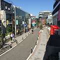
The teenager street for Tokyo! There are lots of small shops for fashion, quirky goods and crepe shops. The street is narrow and can become very crowded, so take care with small children and strollers are not recomended!
CLICK FOR HARAJUKU MAP
The twin-towered Tokyo Metropolitan Government building has 360 degree observatories at the top. Mount Fuji can be seen on clear days, and best near sunset. The elevator ride to the top is free.
CLICK FOR SHINJUKU MAP
This 333 meter high tower is the world's tallest free standing iron structure (taller than the Eifel tower by several meters!). It's about a 15 minute walk from Roppongi station.

This Buddhist temple in Asakusa was originally built in 645 AD. The main hall may be entered for prayer, but making noise and flash cameras are not allowed.
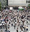
Towering 634 meters above Asakusa, the Tokyo Sky Tree is the tallest structure in Japan. There are two observatories, one at 350 and another at 450. Current prices are around ¥3000 yen/adult ticket.

West about a 10 minute walk from Ginza station is the Imperial Palace, where the Japanese Imperial Family lives. After a lawn of bonzai trees there is the moat and the outer walls.
CLICK FOR GINZA MAP
Shinjuku Koen Park is well laid out with small lakes, flower gardens and sculptured vistas, a tea house, a kiosk, a cafeteria and a large green house. Games/balls are not allowed. Entry 500 adults.
CLICK FOR SHINJUKU GYOEN MAP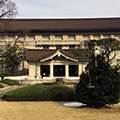
Near Ueno Station, the Tokyo National Museum has the world's largest collection of Japanese art, with sculptures, swords, writing and porcelain. There is also a galleries for Asian art.
Tokyo's Fish Auction and Market moved to a new area, but the old market of cobbled together restaurants and shops is still a great place to get fresh sushi. Most places are open from early morning until 4pm or so.
CLICK FOR GINZA MAP
The new facilities are gleaming, clean, and a bit sterile - visitors look through windows from above. Check out the roof that has a grass field and on clear days a view of Mt. Fuji.
CLICK FOR GINZA MAP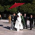
A short walk from Ginza station, the Kabuki Theatre building is impressive and worth a visit. Shows for a single performance with English narration can be bought on the day at the ticket box.
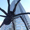
Roppongi Hills and Tokyo Mid-Town are huge office complexes with shops and restaurants. They both offer a gamut of excellent places to shop and eat.
CLICK FOR ROPPONGI HILLS MAP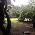
This expansive park near Ginza has open fields, ponds and tea houses. Formerly an imperial garden, it is a great place to take a break from the big city. Entry fee.

The Odaiba area is across Tokyo Bay and has shopping malls, the Miraikan science museum, and other various activities, including a man-made beach.
CLICK FOR ODAIBA MAP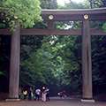
Located a minute from Harajuku Station, Meiji Jingu Shrine is Tokyo's largest. Being next to Yoyogi Park, and nearby the Harajuku shopping area, make this an excellent place to spend an afternoon.
CLICK FOR MEIJI SHRINE MAP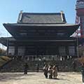
Zozoji Temple was relocated at this location in 1589, but everything except the gate was burned down in WW2. There is also a giant bell and a tree planted by President Grant.
'Cat Street' is a back road between Shibuya and Harajuku with loads of small shops, as well as big brand places. The area has a quaint feel with many narrow side lanes, and no cars along most of the street.
CLICK FOR CAT STREET MAP
A few minute walk from Harajuku Station, Yoyogi Park is Tokyo's largest public parkwith a lot of open green space and a few picnic tables. It's not so busy on weekdays, but weekends can get crowded.
CLICK FOR YOYOGI PARK MAP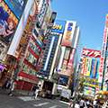
Electric Town in Akihabara is a mash of small shops and big stores all selling electric gear, computer goods, and all types of other equipment.
CLICK FOR AKIHABARA MAP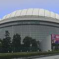
Tokyo Dome is a gigantic stadium near the center of Tokyo where the Tokyo Giants baseball team plays. There are various attractions nearby including the Korakuen amusement park and Korakuen park.
CLICK FOR TOKYO DOME MAP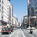
The main shopping drag in Ginza, with shops, department stores and flashy showrooms, is worth a walk down, even if just window shopping.
CLICK FOR GINZA MAP
This temple is famous for having the gravestones of the 47 'Ronin' samurai who took revenge for their master's death, and then committed suicide. About a 15 minute walk from Shinagawa station.
CLICK FOR SHINAGAWA MAP
Once the red light district of Tokyo, it has cleaned up considerably. There are still many show clubs, but also shops, restaurants, and hotels
CLICK FOR SHINJUKU MAP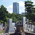
The first public cemetery in Tokyo, Aoyama cemetery dates from 1872 and can be an interesting walk through especially during the cherry blossom season in the Spring.
CLICK FOR AOYAMA MAP
The Diet is where the national party leaders meet and discuss policy. The closest station is Sakura-Daimon station on the Yurakucho line, but it also walkable from Ginza or Hibiya stations.
CLICK FOR GINZA MAPTokyo and Japan’s oldest zoo is a good place to check out caged animals. The most popular draw is giant pandas from China. Entrance fee 600 yen for adults.
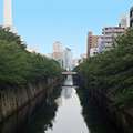
The Meguro river is more a canal than a river and runs to the East side of Nakameguro. Quirky shops, nice cafes and cherry trees line the river.
CLICK FOR NAKAMEGURO MAP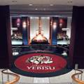
The Ebisu area originally grew up around the Yebisu brewing company, so it's only natural there is a museum dedicated to this frothy beverage here. Tours are offered, and there is a tasting salon.

Sumo Hall holds three tournaments in Tokyo every year - in January, May, and September. See their website for ticket information.